
In the early stages of education, we learn that Earth has seven continents. However, an increasing amount of evidence is prompting geologists to reconsider this long-held notion. They propose that there are actually eight continents, but one has largely escaped notice because it lies mostly submerged beneath the ocean. This eighth continent is known as Zealandia, and interestingly, it is the youngest of all continents.
Approximately 280–230 million years ago, the supercontinent Pangea, which once connected all of Earth’s landmasses, began to break apart. This led to the formation of two new continents: Laurasia in the north and Gondwana in the south. Around 100 million years later, Gondwana underwent its own division, with South America and Africa drifting apart, giving rise to the Atlantic Ocean. Subsequently, Australia and Antarctica separated, but the forces responsible for moving continents were not yet finished.
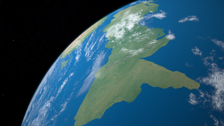
The separation of Antarctica and Australia also led to the creation of a third continent, which drifted away around 80 million years ago. This was Zealandia, and at 1.9 million square miles, it became Earth’s smallest continent. It remained near Australia to the west, but today, it is barely visible on a map. A staggering 94% of Zealandia is submerged beneath the South Pacific. Only its highest peaks remain above water, forming the islands of New Zealand and New Caledonia. So, what happened to this nearly forgotten landmass, and if it is mostly underwater, does it truly qualify as a continent?
Discovering Zealandia

Scientists are just beginning to uncover the history and mysteries of Zealandia because its existence was uncertain until recently. During the Age of Exploration, European explorers such as Abel Tasman and James Cook embarked on quests to find a rumored southern continent called “Terra Australis.” However, after the discoveries of Australia and later Antarctica, the search was largely abandoned.
The notion that a version of Terra Australis might be concealed beneath the ocean was first suggested by the Scottish naturalist Sir James Hector in 1895. He pinpointed its location after a survey expedition around New Zealand. In a paper published by the Royal Society of New Zealand, Hector argued that “New Zealand is the remnant of a mountain-chain that formed the crest of a great continental area that stretched far to the south and east, and which is now submerged.” Although Hector was correct, his ideas were not widely accepted by the scientific community at the time.
It wasn’t until 2017 that Zealandia’s existence was confirmed. A team led by geologist Nick Mortimer from New Zealand research institute GNS Science used rock samples and satellite data to reveal the lost continent, which they announced in a paper published by the Geological Society of America. It was also given a name in the Māori language: Te Riu-a-Māui. Mapping of Zealandia was completed in 2023, showing its imprint emerging from the ocean floor.
The fate of Zealandia

Zealandia formed under unique circumstances unlike any other continent, which ultimately led to its aquatic fate. The continent emerged in a region of intense volcanic activity. Volcanoes shape landmasses in various ways, and in Zealandia’s case, a chain of volcanoes around the current Tasman Sea caused it to separate from Australia and Antarctica. During this process, an unusual event occurred. Tectonic forces pulled the two ends of Zealandia in opposite directions, thinning the continental crust more than that of other continents.
Based on core samples from the seafloor around Zealandia, geologists now believe that the continent’s final submersion coincided with the formation of the Ring of Fire, a chain of volcanoes encircling the Pacific Ocean, forming the most volcanically and seismically active region on the planet. These volcanoes formed roughly between 50 and 35 million years ago, and as a result, the thin crust of Zealandia began to buckle under the violent tectonic forces. The landmass sank, eventually falling almost entirely below sea level. While you might think this sinking means Zealandia is no longer a continent, that’s not the case. Dry land has nothing to do with the definition of a continent, and Zealandia isn’t simply a fragment of the past. However, there is ongoing debate about its exact status.
Continent or microcontinent?

Determining what constitutes a continent can be challenging. There is no consensus on the number of continents Earth has. In the United States, students typically learn that there are seven continents: North America, South America, Europe, Asia, Africa, Australia, and Antarctica. However, some other countries teach that there are six continents, combining the Americas as one. Others recognize five, merging Europe and Asia into one, while some argue there are just four: Afro–Eurasia, America, Australia, and Antarctica. Thus, depending on who you ask, Zealandia could be Earth’s fifth, sixth, seventh, or eighth continent.
Although Zealandia is mostly underwater, scientists have clear evidence that it is indeed a continent. While the area of Zealandia is below sea level, it is distinctly elevated above the rest of the seafloor. Furthermore, analysis of rock samples from Zealandia reveals that its crust is composed of a mix of igneous, metamorphic, and sedimentary rock, unlike the regular ocean floor, which is predominantly igneous rock.
Some have proposed that Zealandia should be classified as a microcontinent—a smaller fragment of continental crust separated from a full-sized continent—with Madagascar being a well-known example. However, the team that confirmed Zealandia’s existence contends that it is large enough to be considered a true continent. The issue is that there is no authoritative body responsible for officially recognizing continents, so Zealandia’s status is likely to remain uncertain for the foreseeable future.